

Update 4:15 p.m.: Read our update from Friday afternoon here — the potential area facing a power shutoff has been expanded.
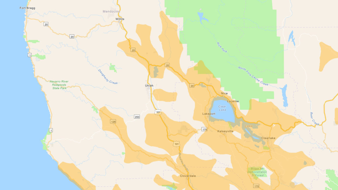
10/25/19 — With record high temperatures and gale winds in the forecast Pacific Gas & Electric is planning to shut off the power once more this weekend, leaving hundreds of thousands or possibly millions of Californians in the dark. They have now released a map of the possible outage areas (you can see it above, or in more detail at this link), though it should be noted that this map will likely change over the next couple days.
During the large planned power outage of a couple weeks ago PG&E’s website crashed and left people without information, so it’s notable that this map appears to be hosted by ArcGIS, and PG&E has made various claims say that this time around their website will not crash.

As of time of publication (about 7:30 a.m.) the areas of Mendocino County that are expected to have their power shut off are: Potter Valley, Redwood Valley and areas around Lake Mendocino, Calpella, Talmage and some parts of unincorporated greater Ukiah, the Anderson Valley and Yorkville, and Hopland and surrounding areas. Areas currently not on the map and not expected to lose power include Willits, Fort Bragg, and Ukiah within city-limits — but this could all change.
Smoke from the Kincade Fire is affecting air quality across the region and will likely be settling over parts of Mendocino County today bringing terrible air:
Thanks! But ArcGIS map does not work…
Ron sheets Willits
Map is working now. Just takes a LONG time to load.
it’s probably because so many people are trying to look at it right now, unfortunately we can’t make the PG&E website any better!